|
Visitor's
Guide to Pinedale, Wyoming |
| Pinedale Online > News > April 2006 > Antelope crossing at Trappers Point Bottleneck > Travel Path |
Back to Article © Photo by |
|
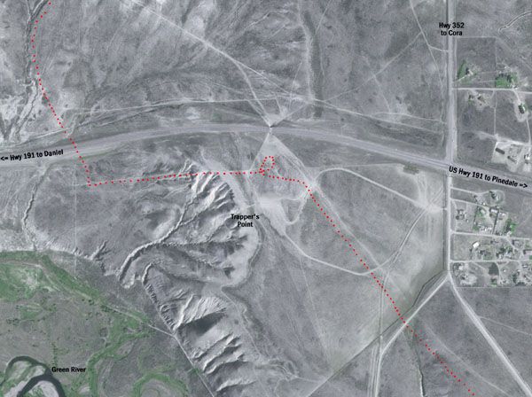
Satellite image showing the approximate path this group of pronghorn took to get across Hwy 191 at Trappers Point, just west of the intersection of US Hwy 191 and Cora Hwy 352. Direction of travel is from the bottom right, north to the top left. Land west of Hwy 352 is public BLM. A private land housing subdivision lies on the east side of Hwy 352 (right). Total time for this group to travel the distance in this photo was approximately 30 minutes on Saturday, April 15. (2002 satellite photo enhanced by Pinedale Online) |
|
Copyright © 2006 Pinedale Online. All rights reserved. |