
Titcomb Basin
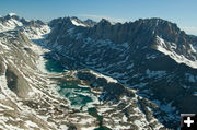
Titcomb Basin and Fremont Peak in the Bridger Wilderness of the Wind River Mountain Range. Photo taken July 25, 2011. Photo by Rita Donham, Wyoming Aero Photo.
|
|
Wind River Mountains from the air – July 25, 2011
Titcomb Basin photos by Rita Donham, Wyoming Aero Photo
August 1, 2011
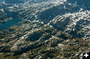
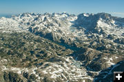
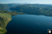
Rita Donham, co-owner of Wyoming Aero Photo, sent in these photos of the trail conditions in the area of Titcomb Basin in the Wind River Mountains. Photos were taken on Monday, July 25th. For more information about current conditions, contact the Pinedale Ranger District of the Bridger-Teton National Forest at 307-367-4326.
Wyoming Aero Photo, based out of Cora, Wyoming, specializes in custom aerial photography for their client’s documentation needs. They can create georeferenced imagery and mosaic layers for GIS, with high resolution and accuracy which makes them excellent for surveys of vegetation, livestock, wildlife, pipelines, and watersheds, as well as community planning and industry purposes. Find out more about their aerial photography services and portfolio from their website: www.wyomingaerophoto.com, 307-231-1326.
|


