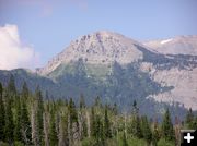
Lander Peak
Lander Peak is a prominent Wyoming Range landmark along the way.
|
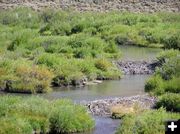
Beaver dams
Beaver dams on North Cottonwood Creek just before McDougal Gap
|
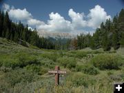
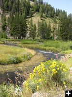
Hardin Creek
Hardin Creek flows into North Cottonwood Creek
|
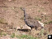
Sage chicken
Sage chicken, one of a group of 8 that were found along the Ryegrass road. We saw ten in all this trip.
|
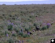
Sage Chickens
Sage chickens along the Ryegrass road
|
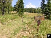
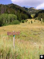
Wyoming Range trailhead
The trailhead for the Wyoming Range scenic trail takes off from McDougal Gap
|
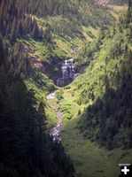
McDougal Pass Falls
Steep waterfalls in McDougal Pass
|
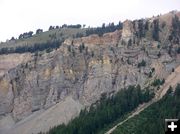
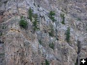
McDougal Pass
Rugged rock cliffs of Mt McDougal at McDougal Pass
|
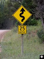
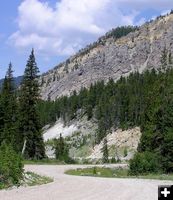
Curvey 25
The McDougal Gap and Greys River roads are narrow and very windy in places
|
McDougal Pass
Imposing mountains tower above the road along through the pass
|
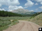
McDougal Gap road
The McDougal Gap road is steep and windy in the pass
|
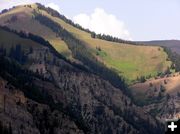
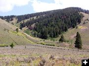
High Valleys Still Green
Grass in the high valleys are still lush and green, unusual for mid-August
|
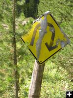
U Sign
The road is very windy in places
|
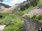
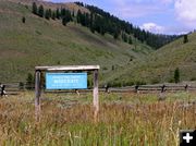
Sheep Creek
|
Sheep Creek
Sheep Creek flows from McDougal Gap into the Greys River
|
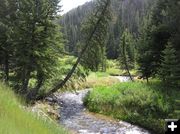
Sheep Creek
|
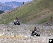
ATVing
There are miles of roads and places to explore with Off Road Vehicles (ORVs)
|
ATV fun
A family from Thayne enjoys using ATVs and motorcycles at an old gravel pit along Sheep Creek
|
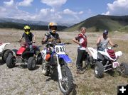
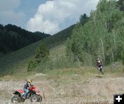
Family from Thayne
This group from Thayne was having a lot of fun using their motorcycles and ATVs in a gravel pit to get great air in jumps
|
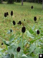
Coneflower seedheads
The pretty yellowflowers are gone now and all that is left of these coneflowers are the brown cone.
|
Buck fence
A buck fence in the National Forest. These unique wood pole fences are common sites in Wyoming.
|
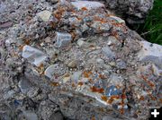
Conglomerate rocks
Large conglomerate rock boulders are found at the top of McDougal Gap
|
Sheep Creek Trailhead
Sheep Creek trailhead
|
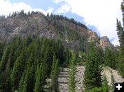
Trees cling to rocks
Trees seem to have an impossible toe-hold on the steep rocks on the McDougal Gap cliffs
|
Fire danger moderate
It is amazing to be mid-August and still have moderate fire danger and green hillsides in the forest
|
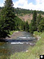
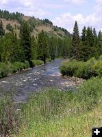
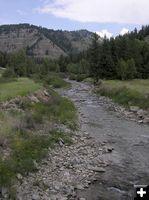
Greys River
Scenic Greys River
|
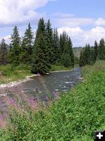
Greys River
Wildflowers are beautiful along the Greys River
|
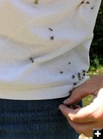
Burrs
Burrs stick to clothing from a walk through the brush. This seed dispersal method was the inspiration for velcro, so we have been told.
|
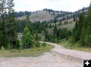
Greys River Road
The road is great for mountain biking, leisurely walks, or a scenic day drive
|
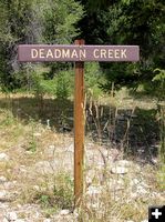
Deadman Creek
There has to be a story behind the naming of this creek...
|
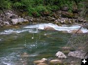
Kayak course
This kayak course is laid out in the rapids of the Greys River
|
Little Greys River
The confluence of the Little Greys River and the Greys River is a popular spot for RV campers
|
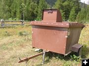
Bear proof dumpster
Bear-proof trash dumpster located at Moose Flats Campground along the Greys River
|
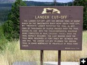
Lander Cut-Off
The area is rich in history about the Oregon Trail. Historical markers are located at significant points along the way.
|
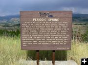
Periodic Springs
Periodic Spring is located 4 miles east of Afton at the end of the Greys River Road.
|
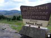
Salt River Pass
Salt River Pass, the divide between the Snake River and the Great Salt Lake drainages
|